

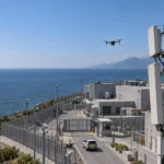




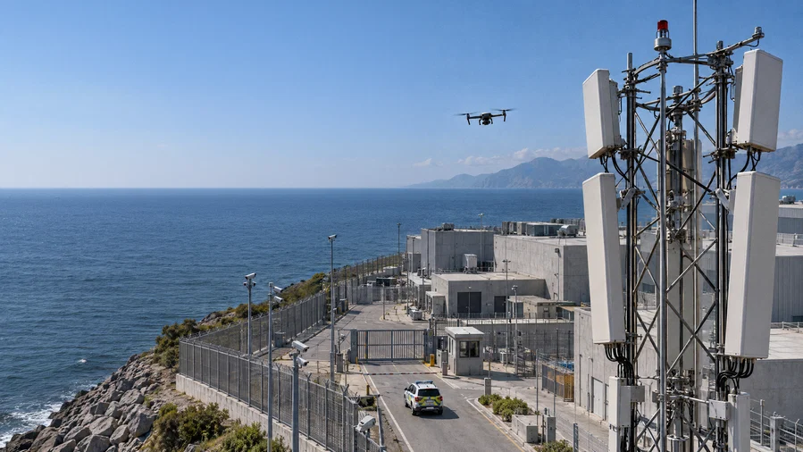
In an era where the proliferation of low-cost, high-speed drones has outpaced traditional surveillance capabilities, Ericsson (NASDAQ: ERIC) has announced a landmark technological shift. The telecommunications giant today introduced the Ericsson ISAC (Integrated Sensing and Communication) System, a solution designed to turn existing 5G mobile infrastructure into a sophisticated, wide-area sensing network. This technology aims to close the critical "low-altitude gap" in national security, protecting everything from power plants and stadiums to international borders from unauthorized or hostile unmanned aircraft systems (UAS).
Main Facts: The New Frontier of Network Intelligence
The Ericsson ISAC System represents a fundamental evolution in how telecommunications infrastructure is utilized. Traditionally, mobile networks have served a singular purpose: the transmission of data between connected devices. However, as the "low-altitude economy" grows and security threats from small, uncooperative drones increase, the need for a ubiquitous sensing layer has become urgent.
A Multi-Layered Security Solution
The ISAC System adds a "sensing" layer to the 5G network, allowing it to detect and track moving objects even when those objects are not connected to the network or emitting any signals. By utilizing sensing-capable 5G radios, advanced AI algorithms, edge computing, and sophisticated signal processing, the system transforms radio reflections into actionable situational awareness.
Addressing the Detection Gap
Small drones are notoriously difficult to track. Their low flight altitudes allow them to fly "under the radar" of traditional aviation surveillance, and their small physical signatures make them nearly invisible to many legacy defense systems. While dedicated sensors like high-end radar or acoustic detectors are effective for specific sites, they are prohibitively expensive to deploy across entire cities or long borders. Ericsson’s solution leverages the existing footprint of 5G towers, providing a cost-effective, wide-area alternative that complements existing security measures.
Chronology: From Validation to Commercial Deployment
The journey toward the Ericsson ISAC System has been marked by rigorous testing and a strategic roadmap that looks toward the next decade of connectivity.
2024–2026: Validation and Proof of Concept
Over the past several months, Ericsson has conducted a series of high-profile "validated tests" and live demonstrations across the globe. These trials were designed to prove that 5G signals could be repurposed for sensing without degrading communication performance.
- Texas, USA: In collaboration with AT&T, Ericsson demonstrated the system’s ability to protect major venues. In Arlington, Texas, the system successfully detected and tracked multiple drones simultaneously, displaying their movements on a real-time sensing dashboard.
- Helsinki, Finland: Working with Erillisverkot, the Finnish state-owned operator for public safety, Ericsson showed how multiple 5G sites could coordinate to provide continuous tracking across a metropolitan area.
- Poland: A joint effort with mobile operator Play and software firm Asseco integrated ISAC technology with acoustic detection systems, proving that a multi-modal approach yields even higher positioning accuracy.
2027: The Initial Commercial Pilot Phase
The commercial introduction of the Ericsson ISAC System is scheduled to begin in 2027. This phase will involve small-scale, "sensing-only" commercial pilots. These early adopters—likely government agencies, defense departments, and operators of critical infrastructure—will use the technology to refine operational procedures and integrate the data into their existing Command and Control (C2) systems.
2028 and Beyond: Scaled Deployment and 6G Integration
Beginning in 2028, Ericsson plans for broader-scale deployments. As the technology matures, the "integrated communications" capability will be fully fused with the sensing data. This evolution is a cornerstone of the industry’s move toward 6G, where sensing is expected to be a native, built-in feature of the network architecture rather than an added-on capability.
Supporting Data: The Mechanics of Multi-Static Sensing
To understand why the Ericsson ISAC System is a breakthrough, one must look at the technical data and the methodology of its operation.
The Multi-Static Advantage
The system operates as a multi-static radar system. In traditional (monostatic) radar, the transmitter and receiver are in the same location. The Ericsson ISAC System, however, distributes transmission and reception across multiple, geographically separate mobile-network sites.
- Diverse Angles: By viewing an object from multiple angles simultaneously, the system significantly increases "detection confidence."
- Track Continuity: As a drone moves out of the range of one tower, it is picked up by another, ensuring a continuous track across a wide coverage area.
- Resilience: The distributed nature of the system means that even if one node is obstructed or compromised, the rest of the network maintains the operational picture.
Performance Metrics in Validated Tests
In official trials, the system demonstrated remarkable precision:
- Range: Reliable detection and tracking of micro-drones at kilometer-scale distances.
- Accuracy: Precise 3D positioning, allowing security forces to determine not just the location, but also the altitude and flight path of a target.
- Classification: Through AI-based signal analysis, the system can distinguish between a bird, a commercial drone, and other moving objects, reducing the frequency of false alarms.
Infrastructure Synergy
The ISAC System utilizes "sunk costs"—infrastructure that is already paid for and operational. This includes:
- Towers and Sites: Physical locations with power and height.
- Backhaul: The high-speed fiber links that carry data from the towers to the core network.
- Spectrum: The radio frequencies already licensed for 5G use.
Official Responses: Voices from Industry and Defense
The announcement has garnered significant support from various sectors, highlighting the diverse applications of the technology.
Freddie Södergren, Global Head of Mission Critical Networks and Defense at Ericsson, emphasized the strategic necessity:
"Low-flying drones create a detection coverage gap that no single sensor can effectively address. Ericsson ISAC System enables multiple 5G sites to deliver coordinated wide-area detection and continuous tracking… It also gives operators a pathway to create new services from existing network assets."
Joe Madden, Principal Analyst at Mobile Experts, pointed to the economic efficiency of the solution:
"Ericsson’s ISAC System shows that mobile-network sensing can perform far better than many expect… By building on an extensive footprint of existing sites, Ericsson has the potential to deliver wide-area drone detection faster and more cost-efficiently than deploying new dedicated sensor infrastructure."
Shawn Hakl, SVP & Head of Product at AT&T Business, highlighted the shift toward "intelligent" networks:
"The next evolution of connectivity is about networks that don’t just move data but help organizations with insights… Deploying this technology in a complex environment like a stadium is an important example of how intelligent networks can drive better safety and security outcomes."
Representing the defense sector, Carl Lundqvist, Chief Architect of the Swedish Armed Forces HQ, noted:
"Detecting small drones across large areas is a growing operational challenge. The possibility of using distributed infrastructure to complement existing sensors could provide an important additional layer of situational awareness."
Implications: Reshaping the Low-Altitude Economy and Public Safety
The introduction of the Ericsson ISAC System has profound implications for several sectors of the global economy and security landscape.
1. Strengthening National Security and Defense
As modern warfare and organized crime increasingly rely on small, inexpensive drones for sabotage and surveillance, the ISAC system provides a "digital fence." For border security, it offers a way to monitor long stretches of land or coastline that were previously too expensive to cover with traditional radar.
2. Safeguarding Critical Infrastructure
Power plants, water treatment facilities, and transport hubs are highly vulnerable to drone-based threats. By integrating ISAC data with mitigation platforms (such as signal jammers or interceptors), these facilities can move from a reactive posture to a proactive one.
3. Enabling the "Low-Altitude Economy"
The commercial drone industry is poised for explosive growth, with applications in delivery, environmental mapping, and infrastructure inspection. However, this growth requires a robust Unmanned Traffic Management (UTM) system. The Ericsson ISAC System provides the "air traffic control" for the low-altitude sky, ensuring that authorized drones can operate safely while unauthorized ones are immediately flagged.
4. Smart Cities and Digital Twins
Beyond security, ISAC technology can be used for environmental mapping and smart-city planning. By sensing the movement of vehicles and objects in real-time, cities can create "Digital Twins"—virtual models that help optimize traffic flow, reduce emissions, and improve urban logistics.
5. The Road to 6G
The Ericsson ISAC System is more than just a product; it is a preview of the 6G era. In 6G, the network will act as a "sixth sense," providing a digital representation of the physical world. This announcement signals that the transition from a communication-only network to a sensing-and-communication network is already underway.
Conclusion
With the launch of the ISAC System, Ericsson is positioning the mobile network as a foundational element of national resilience. By bridging the gap between digital connectivity and physical awareness, the company is providing a scalable, efficient, and technologically advanced solution to one of the most pressing security challenges of the 21st century. As commercial pilots begin in 2027, the world will be watching to see how this "invisible shield" transforms the safety of our skies.