





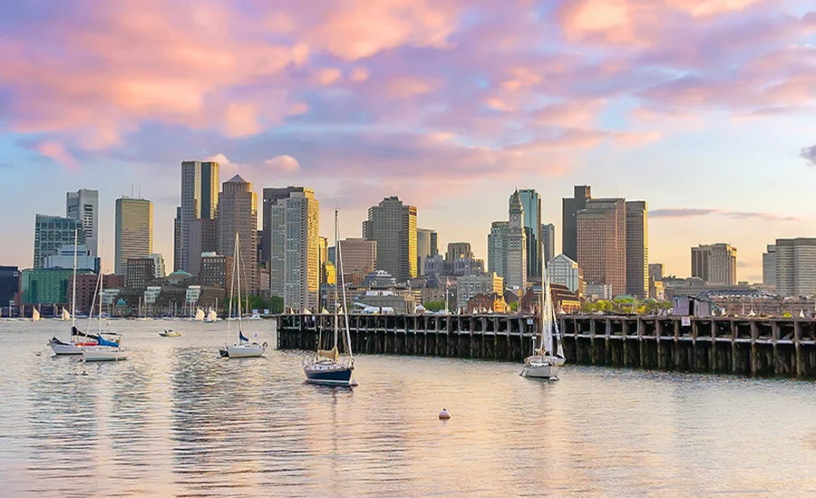
As sea levels rise and extreme weather events become the new standard, the city of Boston stands at a critical juncture. The U.S. Army Corps of Engineers (USACE), in partnership with city officials, has unveiled a comprehensive draft study that proposes a $10 billion overhaul of Boston’s 47-mile coastline. This ambitious infrastructure plan, released on July 24, represents one of the most significant efforts in the nation to fortify a major urban center against the encroaching Atlantic Ocean.
The study scopes at least 20 distinct infrastructure projects targeting 16 miles of the most vulnerable stretches of the city’s waterfront. By combining hard engineering—such as sea walls and tidal barriers—with nature-based solutions, the plan aims to insulate Boston’s historic neighborhoods and economic engines from the catastrophic flooding projected for the coming decades.
The Urgency of Inundation: Supporting Data
The impetus for this massive public works undertaking is rooted in sobering scientific projections. According to the Green Ribbon Commission, a coalition of local business and civic leaders, Boston is expected to face between 10 and 18 inches of sea-level rise by 2050 alone. By the end of the century, these figures could climb significantly higher depending on global greenhouse gas emission trajectories.
The USACE provided a visual representation of this threat in a recently released screening map, which illustrates areas around Boston Harbor that would succumb to a 1% annual-chance coastal storm by 2090. Under an "intermediate" sea-level rise scenario, large swaths of the city’s inner harbor would be submerged. Under a "high" scenario, the inundation area expands significantly, reaching deep into the downtown district, the Seaport, and residential enclaves that were once considered safe from tidal surges.
The economic implications are equally daunting. The USACE estimates that if Boston remains in its current state, failing to implement structural defenses, the city could face as much as $54 billion in losses by the year 2100. Conversely, the cost-benefit analysis of the proposed projects is compelling: for every $1 invested in these protective measures, the public sector stands to save at least $4 in avoided damages and disaster recovery costs.
Official Responses and Strategic Vision
The collaboration between the federal government and the city of Boston underscores the magnitude of the challenge. "The future of our city depends on the steps we take now to build resilient communities," said Boston Mayor Michelle Wu (D) in a formal statement. "With more frequent flooding in vulnerable areas during extreme weather events, the Coastal Storm Risk Management Feasibility Study is critical to understanding how to protect inland neighborhoods most at risk and unlocking resources to take action."
From the perspective of the USACE, the "do-nothing" approach is officially off the table. Lt. Col. David MacPhail, deputy commander of the Corps’ New England District, emphasized the necessity of the project, stating, "The reality is that doing nothing is not a viable option. Without action, the costs to public safety and economic vitality from coastal flooding will only be compounded."
The private sector, represented by the Green Ribbon Commission, is echoing these sentiments with increased urgency. Rebecca Herst, the commission’s associate director and director of climate resilience, noted that the city’s largest employers are viewing flood risk as an existential threat. "Our members represent some of the largest institutions and employers in Boston, and they are telling us clearly that reducing risk from flooding is an urgent priority to be solved before it’s too late," Herst said.
A Chronology of Resilience Planning
The current draft study is the culmination of years of data gathering and policy shifts.

- 2023-2024: Intense feasibility studies were conducted by the USACE to model storm surges and identify the 16 miles of coastline requiring immediate intervention.
- 2025: The state of Massachusetts released the "ResilientMass" finance strategy, which laid the groundwork for how the state and local municipalities might shoulder the burden of large-scale climate adaptation funding.
- July 24, 2026: The USACE and the City of Boston jointly release the draft Coastal Storm Risk Management Feasibility Study, opening the door for public comment.
- September 18, 2026: The deadline for the public to submit feedback on the draft analysis.
- Summer 2027 (Projected): The Green Ribbon Commission, in conjunction with the USACE, aims to finalize a comprehensive financial blueprint, syncing with the final federal feasibility study.
The Financial Challenge: Bridging the Gap
While $10 billion is the headline figure, project planners acknowledge that the final price tag will likely be higher. The initial estimate covers the core structural defenses but does not fully account for secondary upgrades, such as improvements to public access to the harbor, parkland enhancements, or the integration of "green infrastructure"—such as living shorelines, marshes, and bioswales—that the city intends to pursue alongside the USACE projects.
The financial structure requires the city to cover 35% of the total project costs under the federal cost-share agreement. To meet this, a task force—led by global consultant Arcadis, alongside Throwe Environmental and the Consensus Building Institute—is working to identify innovative funding mechanisms.
Carly Foster, Arcadis’ water management practice director, highlighted that the financial strategy must be as robust as the engineering. "The first task is to really define the cost that we’re trying to get to, and it’s not just the capital cost because programs like this have to be maintained," Foster told ENR. "There’s going to be a broad range of potential costs that we’re facing depending on the implementation schedule as well as the delivery model."
One strategy the task force is evaluating is the shift toward "progressive design-build" project delivery. According to Foster, clients who utilize this model for climate adaptation projects are seeing cost savings of 25% to 33% compared to the traditional design-bid-build approach. By bringing the contractor on board early in the design phase, the city can optimize the construction process, manage risk more effectively, and avoid the change-order bloat that often plagues massive civil works projects.
Implications for the Future of Urban Development
The Boston project is being watched closely by other coastal cities, including New York, Miami, and San Francisco, as a potential prototype for 21st-century urban resilience. The primary implication of this study is the total integration of climate adaptation into the city’s master planning.
The 20 proposed projects are not merely defensive walls; they are intended to reshape the way residents interact with the harbor. By closing off pathways that lead to flood-prone areas, the city hopes to preserve its economic vitality while simultaneously creating a more accessible, climate-ready waterfront. However, the success of this vision depends entirely on political will and financial ingenuity.
"The Army Corps project is a generational opportunity to receive federal funding to invest in our coastline," said Herst. "But Boston needs a strategy that is viable and implementable to meet the match."
As the city enters the public comment period, the conversation is shifting from "if" these projects should be built to "how" they can be funded and maintained for the next 100 years. The proposed $10 billion investment is a daunting figure, but in the face of a $54 billion potential loss, it represents a necessary, calculated pivot toward a future where Boston remains a thriving hub despite the rising tides.
The final feasibility study, expected next year, will ultimately dictate the pace of construction. Until then, the city remains in a race against time, balancing the demands of modern infrastructure development with the unpredictable nature of an evolving global climate.